|
| Joshua Tree - Lost Horse Mine Loop Trail |
| Rating | ***** |
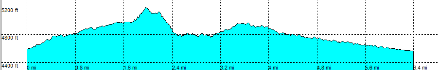
| length | 6.4 mile - 3 hour 20 minutes (round trip). Moderate. |
| Height | 4600 - 5190 feet |
| Access | All Cars. On Park Blvd/loop Rd (main Park road) take Keys View Rd. Turn left on a signed dirt road (normally ok for all cars). At the end, park in the parking area. |
| Other Trails | None |
| Data | To download these files, right-click the link and choose 'save as' |--| .GPX (GPS file) |-----| .KML (Google Earth file) |